
From Wikipedia, the free encyclopedia
Content deleted Content added
|
Most recent census data only. |
Adding short description: “Village in Suffolk, England”, overriding automatically generated description
|
||
| Line 1: | Line 1: | ||
|
{{Short description|Village in Suffolk, England}} |
|||
|
{{Distinguish|Hopton-on-Sea}} |
{{Distinguish|Hopton-on-Sea}} |
||
|
{{Use dmy dates|date=October 2019}} |
{{Use dmy dates|date=October 2019}} |
||
Latest revision as of 14:49, 17 October 2024
Village in Suffolk, England
Human settlement in England
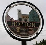
| Hopton | |
|---|---|

|
|
| Population | 653 (2011)[1] |
| District | |
| Shire county | |
| Region | |
| Country | England |
| Sovereign state | United Kingdom |
| Post town | DISS |
| Postcode district | IP22 |
| Police | Suffolk |
| Fire | Suffolk |
| Ambulance | East of England |
| UK Parliament | |
Hopton is a village and civil parish in the West Suffolk district of Suffolk in eastern England. Located just south of the Norfolk border on the B1111 road between Stanton and Garboldisham, in 2011 it had a population of 653. It shares a parish council with neighbouring Knettishall.
All Saints’ Church is at the geographical centre of the village, it has regular services and is part of the United Benefice of Stanton, Hopton, Market Weston, Barningham & Coney Weston.[2]
There is a primary school, and a pre-school. The primary school feeds students both to Thurston Community College in Thurston and Ixworth Free School in Ixworth.
- ^
“Civil Parish 2011”. Neighbourhood Statistics. Office for National Statistics. Retrieved 23 August 2016.
- ^ United Benefice of Stanton, Hopton, Market Weston, Barningham & Coney Weston
![]() Media related to Hopton, Suffolk at Wikimedia Commons
Media related to Hopton, Suffolk at Wikimedia Commons


