GPS, history, working, uses
GPS, history, working, uses
Stands for?
GPS stands for Global Positioning System. It is a satellite navigation system that provides accurate location and time information to users anywhere in the world.
What is Global Positioning System?
It consists of a network of orbiting satellites, ground control stations, and receivers or devices. It a space radio navigation system that transmits highly accurate navigation pulses to users on or near the Earth. In the American GPS system Navstar, 24 large satellites revolve around the earth every 12 hours in 6 orbits.
History:
The history dates back to the middle of the 20th century. Here are the main milestones in its development:
Conceptualization: The idea was first proposed in the early 1960s by the United States Department of Defense. They envisioned a set-up that could provide precise positioning and navigation capabilities for military purposes.
Transit System: In 1960, the US Navy launched the Transit System, the first satellite navigation system. Transit used a constellation of satellites to provide navigation data, primarily for submarines and ships. It used Doppler shift measurements to determine location, but had limited accuracy.
Timekeeping System: In the 1960s, the United States Naval Research Laboratory developed a timekeeping set-up that pioneered the use of atomic clocks on satellites to accurately synchronize time. This technology formed the basis for the precise positioning capabilities of future systems.
Development: The development of as we know it today began in the early 1970s. The United States Department of Defense initiated the Navstar GPS program to create a global navigation system for military and civilian use. The program aimed to develop a constellation of satellites, ground control stations and user receivers.
Satellite prototypes: The first experimental set-up, named Navstar-1, was launched in 1978. It was followed by several satellite prototypes to test the system's functionality, accuracy, and compatibility with users' receivers.
Full operational readiness: By the late 1980s, the GPS system had reached initial operational readiness (IOC), meaning it was partially usable by military users. The system provided positioning and navigation services with sufficient accuracy, but selective availability (SA) deliberately degraded the quality of civilian signals for safety reasons.
End of Selective Availability: In 2000, US President Bill Clinton ordered the end of selective availability, making pinpoint accuracy GPS signals available for civilian use. This decision has significantly increased the usefulness of GPS for civilian applications.
Modernization and expansion: Since the 2000s, the system has been continuously modernized. This includes the introduction of new generations of satellites, improved accuracy, signal amplification and the development of additional civil signals. The updated system is known as GPS.
In 2003, physicist Dr. Ivan Getting and engineer Colonel Bradford Parkinson received the prestigious Draper Award from the National Academy of Engineering for making GPS a reality. But while no one disputes the importance of their role, none of them are responsible for the key to GPS's success: equipping each satellite with incredibly accurate "atomic clocks" to pinpoint its position to within a few centimeters.
Integration of other GNSS. Over time, other countries have developed their own satellite navigation systems, such as GLONASS (Russia), Galileo (European Union), BeiDou (China) and NavIC (India). Attempts have been made to integrate these systems with GPS, allowing users to use more constellations and improve positioning accuracy.
Elements:
Global Positioning System consists of three different components called segments that work together to provide location information.
Three segments:
1)Space (satellites): That orbit the Earth and send signals to users about the geographic location and time of day.
2)Ground controls: The control segment consists of ground monitoring stations, main control stations, and a ground antenna. Monitoring activities include monitoring and control of satellites in space and monitoring of broadcasts. Nearly each continent in worldwide, especially North and South America, Africa, Europe, Asia, and Australia, has monitoring stations.
3)User Equipment: GPS receivers and transmitters, including items such as watches, smartphones, and telematics devices.
How work?
In short it works like this:
21 GPS satellites and three reserve satellites are in orbit 17,000 kilometers above the Earth. These are spaced so that there are four satellites above the horizon from any point on Earth.
Each satellite is equipped with a radio, an atomic clock, and a computer. Knowing its orbit and clock, it constantly broadcasts its changing position and time. (Once a day, each satellite checks its sense of time and position with the ground station and makes any minor adjustments.)
On land, each receiver contains a computer that "triangulates" its location by receiving bearings from three satellites. The result is a geographic location - longitude and latitude - within 100 meters for most receivers.
If the receiver is also equipped with a display and a map, the position can also be displayed.
If a fourth satellite can be received, the receiver/computer can determine the altitude and geographic location.
When you are on the road, your receiver can also calculate the speed and direction of your journey and give you an estimated time of arrival at the destinations you specify.
GPS is being used in science to provide data never before available, in the amount and degree of accuracy that GPS allows. Scientists use them to measure the movement of Arctic ice sheets, Earth's tectonic plates and volcanic activity.
Mobile GPS technology has made today's smartphones a convenient and highly efficient means for end users to receive navigation instructions through a global positioning system called "trilateration". The phone's built-in GPS also communicates with a number of satellites that provide navigation instructions to people driving or walking. More technologically advanced phones can identify individual streets and points of interest on maps and provide annotated tracking.
Accuracy?
The accuracy of this device depends on many variables, such as the number of satellites available, the ionosphere, the urban environment, and more.
Here are some factors that can reduce accuracy:
Physical Obstacles: Arrival time measurements can be distorted by large masses such as mountains, buildings, trees and more.
Weather Effects: Ionospheric delays, severe storm coverage, and solar storms can affect our devices.
Ephemeris: A satellite's orbital model may be incorrect or outdated, even though it is becoming increasingly rare.
Numerical miscalculations: This may be the reason why the hardware of the device is not within specifications.
Artificial Interference: Includes devices that interfere with GPS or simulators.
Accuracy is generally better in open areas where there are no adjacent tall buildings to block signals. This effect is known as the urban divide. When the device is surrounded by large buildings, such as in downtown Manhattan or Toronto, the satellite signal is first blocked and then reflected by the building, where the device finally reads it. This can lead to a wrong calculation of the distance to the satellite.
Applications:
GPS technology has many applications in different fields. Here are some common ways to use:
Navigation: It is widely used for navigation purposes. It helps people and vehicles pinpoint their exact location, plan routes and get real-time directions. Such navigation set-ups are widely used in cars, smartphones and other portable devices.
Vehicle Tracking and Fleet Management: This systems are used to track the location and movement of vehicles. It is useful for fleet management, logistics and transportation companies to track their assets, optimize routes, improve efficiency and improve safety.
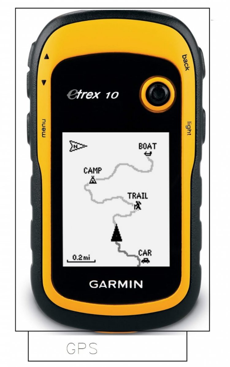
Outdoor Recreation: They are popular with outdoor enthusiasts such as hiking, camping, and geocaching. This allows users to navigate unfamiliar terrain, mark waypoints and create their own routes. GPS devices with topographic maps provide valuable information about trails, elevation changes, and landmarks.
Aviation: It plays a vital role in aviation navigation and safety. It is used for precise air navigation, flight planning, approach and landing procedures, and air traffic control. GPS improves accuracy and reliability, especially in areas where traditional land navigation aids are limited.
Marine Navigation: They widely used in marine applications for navigation, mapping and collision avoidance. It helps sailors, fishermen and merchant ships to determine their position at sea, plan routes and navigate safely.
Investigate and map: This technology has revolutionized tracking and mapping. Provides accurate positioning and data collection for surveying, construction projects, natural resource mapping and geospatial analysis.
History and Timing: It provides highly accurate timing signals commonly used for timing in telecommunications, financial transactions, power grid management, scientific research, and network operations. Accurate time information from satellites is essential for keeping accurate timekeeping and coordinating activities.
Emergency services: It helps emergency services such as the police, fire brigade and medical services to locate incidents quickly and efficiently. Helps locate emergency calls, locate emergency vehicles and provide accurate directions to the crime scene.
What's Your Reaction?