Gravimeter, Types, Working
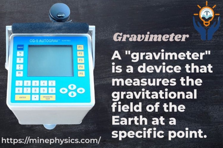
"Gravimeter" is a sensitive device that measures the gravitational field of the Earth at a certain spot.
Define?
It is a sensitive device for detecting changes in the gravitational field of the Earth. With the aid of gravimeters, geological structures with varied densities beneath the surface of the Earth can be studied, such as mineral or oil deposits that affect the regional gravity above.
A gravimeter is a specific kind of accelerometer that measures gravity's steady downward acceleration in order to precisely determine the strength of a gravitational field at a certain location.
Who Discovered?
Physics expert and meteorologist Lucien LaCoste (1908–1995). In addition to the zero-length spring and automobile gravimeters, he also created the contemporary gravimeter. In addition, he helped found the renowned gravimetric equipment retailer LaCoste Romberg.
Types:
There are two types: absolute and relative.
1) Absolute Gravimeters:
They are gravity meters that use absolute units to measure local gravity.
Like the Autograv CG-5 type, they are lightweight and portable and may be used outdoors.
They operate by gauging a mass's acceleration during free fall in a vacuum.
The accelerometer has a strong connection to Earth.
2) Relative:
The spring-loaded relative gravimeters have an extremely high sensitivity (m) and a fixed mass.
Gravity changes as the location does, which affects how much the solid mass weighs.
The spring's length will thus differ greatly depending on the region.
A suitable optical, mechanical, or electrical amplification accurately measures the spring tension.
It is periodically calibrated at the base station, where the absolute value of gravity is known.
At measurement stations, absolute gravity measurements are computed using the International Gravity Standardisation Network.
What is the Unit of Measurement?
While the gravimeter shows data in units called gals, where one gal is equal to 1 cm/s2, the simple accelerometer displays data in traditional units of acceleration. Between 976 and 983 gallons are used to measure the gravity of the Earth at its surface.
Working:
Gravimeters work by measuring the increasing speed due to gravity at a given point. The fundamental guideline is to identify and evaluate little changes in gravity acting on a mass or other quantifiable component. Here's a common diagram of how a gravimeter works:
Mass-spring Framework: In a conventional spring-loaded gravimeter, the instrument comprises of a mass connected to a spring. The mass hangs in a steady position and encounters gravity. The drive extends or compresses the spring, moving the mass.
Uprooting Estimation: Relocation of mass is measured utilizing distinctive strategies depending on the sort of gravimeter. It can be measured optically, with laser interferon, or with capacitive or inductive sensors. Estimation of uprooting is basic to deciding gravitational speeding up.
Calibration: Sometimes recently taking estimations, gravimeters are calibrated to guarantee exactness. Calibration includes comparing the reaction of the instrument to known gravitational increasing speeds, regularly utilizing a supreme gravimeter as a reference.
Natural Rectifications: Gravity meters must account for a few natural variables that can influence the readings. Components such as temperature, weight, and tilt of the instrument can cause mistakes. Advanced gravimeters have built-in sensors to screen and rectify these components.
Data Examination: After measuring the relocation and applying natural rectifications, the information is handled and analyzed to calculate the gravitational speed up in that area. This incorporates applying the proper math equations and calibrations.
Uses:
Gravimeters have a few critical applications in logical inquiry about, geophysics, and different businesses. Here are a few common employments for gravimeters:
Gravity Inquire About: Gravimeters are broadly utilized in gravimetric inquiries to map and ponder changes within the Earth's gravitational field. These studies give important data approximately subsurface topographical structures, structural movement, and potential mineral stores. Gravity data is regularly combined with other geophysical information to form point-by-point models of the Earth's insides.
Geophysical Investigation: They are utilized in mineral investigation and asset appraisal. By measuring little changes in gravity, gravimeters can offer assistance in deciding the potential area of mineral stores, hydrocarbon stores, and groundwater resources. Gravity overviews are especially valuable for distinguishing thick rocks or underground cavities which will show the nearness of minerals.
Observing Volcanoes: These are utilized to screen volcanic movement and identify changes within the magma chambers underneath volcanoes. By measuring minor vacillations in gravity, researchers can track the development of magma and recognize potential volcanic dangers. Gravity changes can demonstrate the aggregation or release of magma, giving profitable experiences into volcanic forms.
Groundwater Administration: They play a part in checking and overseeing groundwater assets. By measuring changes in gravity over time, gravimeters can offer assistance in appraising the consumption or renewal of groundwater. This data is fundamental for economical water management and arranging.
Geodesy and Geodetic Study: Gravimeters are utilized in geodesy, the science of measuring the shape, introduction, and gravitational field of the Soil. They help to precisely decide the tallness of the geoid and demonstrate the Earth's gravitational field. This information is required for geodetic overviews, lackey situating, and route frameworks.
Seismic Tremor Inquire About: Gravimeters are utilized in seismic tremors inquire about to track and consider the development of structural plates. By measuring changes in gravity, researchers can consider the tension and stretch that happens along blame lines. This information makes a difference in getting seismic tremor flow and contributes to the evaluation of seismic risks.
Development and Building: They are now and then utilized in construction and designing ventures to screen ground soundness and settlement. They can offer assistance to evaluate the solidness of structures such as dams or buildings and give early caution of potential subsidence or ground development.
Clear
What's Your Reaction?